Gentle Desert Rain

Droplets on Palo Verde

We have been getting delightful rain showers for the last two days. The forecast says it is just about over, though. We welcome the rain anytime in the desert as long as it isn’t one of those destructive microbursts like we had last summer.

This picture was taken during a lull in the shower activity. I noticed the water droplets clinging to the Palo Verde out front and thought they looked very pretty. Click on the image to enlarge.

Tesla Fail

Tesla Fail

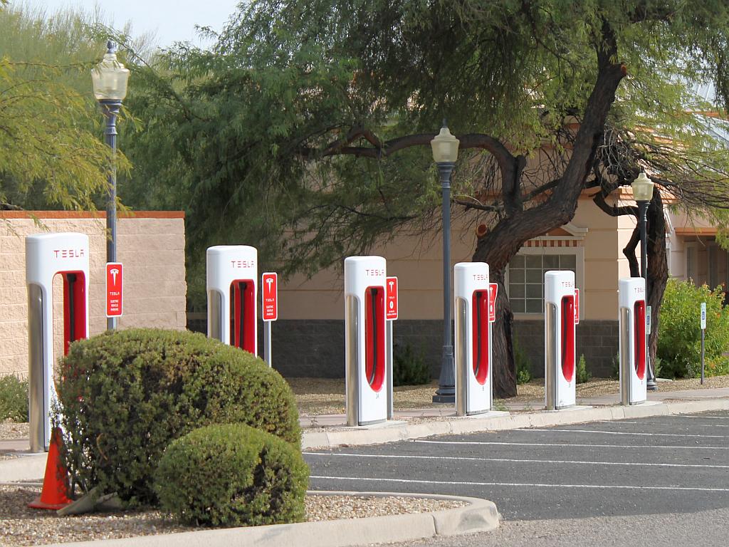
Early this year, the Town of Wickenburg authorized a lease of several parking spots at the Downtown Courthouse to Tesla Motors for the purpose of installing several Supercharger Stations for the Tesla electric cart (not an actual automobile IMHO). Tesla did install six of the stations within walking distance to all of the downtown attractions and businesses, but the chargers seem to seldom be in use.

I think Tesla sold the Town on the “Field of Dreams” concept that if they built it, Greenbat Tesla owners would flock to Wickenburg to spend money while charging their glorified golf carts for free. It isn’t happening. Six stalls? Really?

I asked one of the town public works people who pays for the electricity. Tesla pays, was the answer and not the town. Now, I’m a bit skeptical that Tesla foots the cost of the stations and bills associated with them. I’m sure that the US Government (read TAXPAYERS) heavily subsidize Tesla and the other hydraulic hallucination* electric car companies such that there is the usual waste of revenue going toward these projects and thus down the economic drain hole.

* a paraphrase for “Wet Dream.”

Winter Cactus Flower

Winter Cactus Flower

I bought a potted seasonal cactus at the supermarket earlier this month. The flowers have been opening on it ever since then.

This variety is frequently called Thanksgiving or Christmas Cactus since the plant flowers bloom during our year-end holidays. See the Wikipedia reference to Schlumbergera.

I took this photo yesterday in our outdoor patio. Click on the image to enlarge.

Thanksgiving Snark

I like the way Ramirez thinks . . .

Snark

Regardless of the riots, illegal alien infestation and other things wrong in our country and on the planet, may the Thanksgiving holiday find you all grateful for the good things. Happy Thanksgiving from both of us!

Real Time Lightning Monitor

Lightning Monitor

I ran across this interesting site last week while surfing. Blitzortung is a near real-time display of recent lightning strikes worldwide. The image above was from yesterday, but I just checked the site a few minutes ago and there is a line of strikes across the southeast US as I write this.

The color of the individual strike pixels is time-dependent; white indicates very recent strikes (less than 20 minutes), while dark red indicates oldest (up to two hours old). As you watch the display, each strike is surrounded by an expanding circle for a second or two. The green radial lines each extend to the location of a detector in the network reporting the recent strike and are also only displayed a short time.

I recall from my piloting days a device called a “storm scope” which also reported azimuth and distance information for lightning strikes. It was much less expensive than airborne radar and was effective for guiding aircraft around the more intense storms. Blitzortung is the first on-line display of this nature that I have found.

Vulture Peak on a Cloudy Day

Vulture Peak on a Cloudy Day

I haven’t posted a picture of this unique mountain peak for over a year. At that time, the weather conditions were clear and not with clouds as in this photo. There was a chance of showers yesterday when we were at the dog park, but they never materialized.

Some interesting facts about this mountain range from Wikipedia:

The Vulture Mountains are about 29-mi long, and east of center, about 13 mi wide; the range is somewhat crescent shaped, mainly trending east-west, and narrowing westwards. The northeast is followed by the course of a southeast stretch of the Hassayampa River; the river turns due-south west of Morristown, on US 60, making the east terminus of the range about 7 mi wide, at the rivers floodplain. The Hassayampa enters the north of the Hassayampa Plain, so a small river canyon region lies at the Vulture Mountain’s northeast, with the Wickenburg Mountains northeast, and the Hieroglyphic Mountains east.

The highpoint of the range is Vulture Peak, 3,658 feet (1,115 m)), at the center east of the range. Another major peak anchors the west region of the range, Black Butte, at 3,612 feet (1,101 m)).