Travel

Cameron Garden

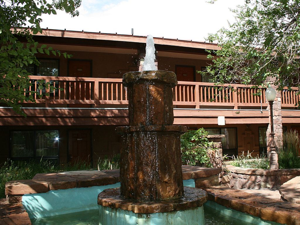
One of the nicest places we stayed when we were on vacation is the Lodge at Cameron Trading Post on US 89 near the east entrance to Grand Canyon. If we’re in that area, whether we’re going through the Canyon or not, we like to stay at Cameron. This is a view of the garden area fountain inside of the lodge complex. You would find it hard to believe that you’re in an arid climate when you’re in this nice garden patio.

garden fountain

Click on the image for close up view.

Mather Point – A Grand Canyon Panorama

On the south side of the Colorado River, the panorama at Mather Point extends from the lower end of Garden Creek taking in some of the Bright Angel Trail, over the deep canyon of Pipe Creek and eastwards to Cedar Ridge/O’Neill Butte, along which runs the South Kaibab Trail starting from the next point to the east – Yaki. Some of the Tonto Trail is also in view, near Pipe Creek. On the North Rim, the vista is centered on the long, straight Bright Angel Creek, flowing for 10 miles between a collection of tall red buttes and other ravines.

Text above borrowed from American Southwest dot net.

I took this photo from the trail between Mather point and the Grand Canyon Village. You can see a throng gathered on the point at the far right end of the panorama. Click on the image to see the full size image in the viewer.

mather-pan.jpg

Natural Varnish on Sheer Canyon Walls

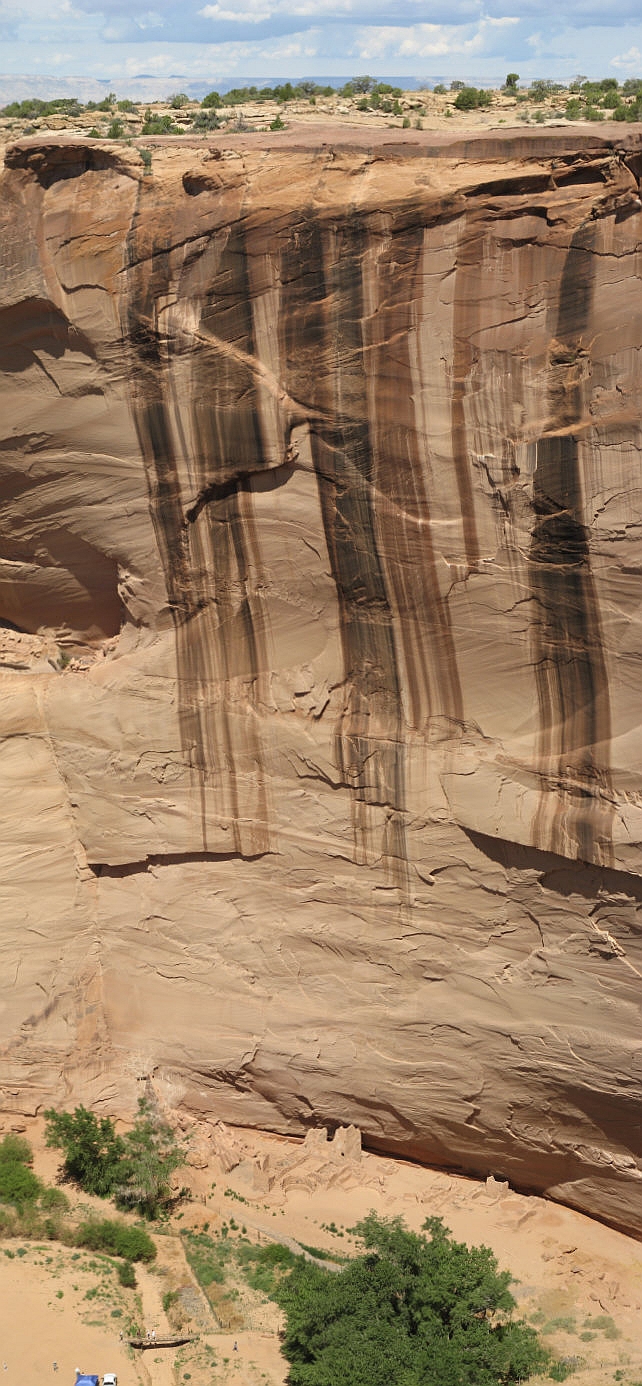
Desert VarnishAlmost everywhere we went on our vacation through Utah and Arizona, we would see this natural desert varnish that forms on the walls of canyons like this one at Canyon del Muerto, a part of the Canyon de Chelly National Park. I took a series of photos to get this vertical panoramic view of the sheer cliff from the rim of the canyon all the way down to the native Ruins at the base.

From Wikipedia:

Desert varnish forms only on physically stable rock surfaces that are no longer subject to frequent precipitation, fracturing or sandblasting. The varnish is primarily composed of particles of clay along with iron and manganese oxides. There is also a host of trace elements and almost always some organic matter. The color of the varnish varies from shades of brown to black.

Originally scientists thought that the varnish was made from substances drawn out of the rocks it coats. Microscopic and microchemical observations, however, show that a major part of varnish is clay (which could only arrive by wind). Clay, then, acts as a substrate to catch additional substances that chemically react together when the rock reaches high temperatures in the desert sun. Wetting by dew is also important in the process.

Another important characteristic of desert varnish is that it has an unusually high concentration of manganese. Manganese is relatively rare in the earth’s crust, making up only 0.12% of its weight. In desert varnish, however, manganese is 50 to 60 times more abundant. This significant enrichment is thought to be caused by biochemical processes (many species of bacteria use manganese).

Even though it contains high concentrations of iron and manganese, there are no significant modern uses of desert varnish. However, some Native American tribes created petroglyphs by scraping or chipping away the dark varnish to expose the lighter rock beneath.

Desert varnish often obscures the identity of the underlying rock, and different rocks have varying abilities to accept and retain varnish. Limestones, for example, typically do not have varnish because they are too water soluble and therefore do not provide a stable surface for varnish to form. Shiny, dense and black varnishes form on basalt, fine quartzites and metamorphosed shales due to these rocks’ relatively high resistance to weathering.

Click on the image for the really big view.

Adobe Hacienda

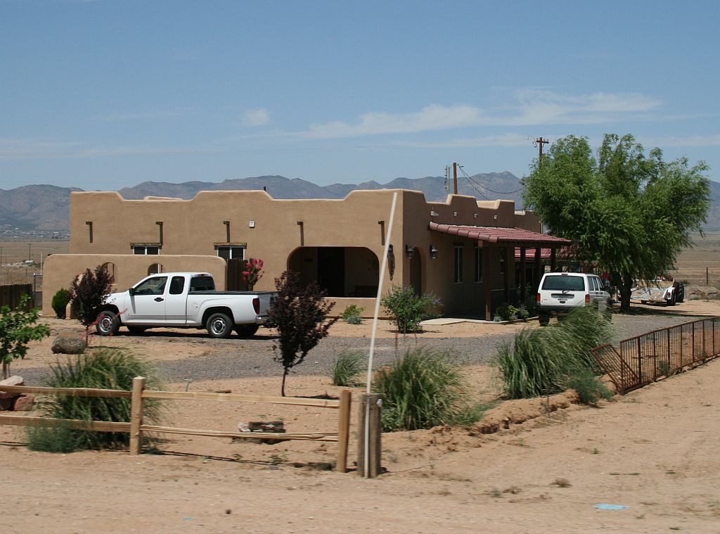
We saw this house on old Route 66 between Seligman and Kingman, Arizona. I have always loved southwestern style architecture. This house is quite a bit like one that I would love to live in someday. On a quarter acre not too far out of town with a spectacular view would suit me fine.

adobe-hacienda.jpg

Gun Show Report

foamAs part of our usual routine, we took off for the gun show. The big story today wasn’t so much about the gun show, but about the 25 mile journey each way.

Normally, we get on the interstate and head towards the next county where the show is held. Today was no different until we spotted a column of smoke off in the distance. Something was fully engulfed in fire up ahead but we didn’t know what.

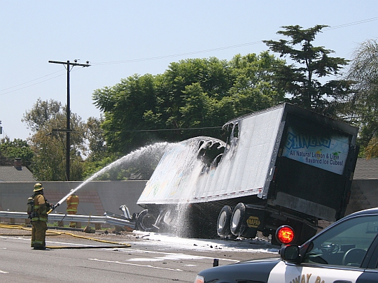
We continued down the interstate when it started to become apparent that the smoke was either right next to the road or maybe on it. Traffic started to back up and we eventually slowed to a stop. Stop we did and parked in that very spot for the next 20 to 25 minutes. We tuned to the radio to hear that a big rig and a motorist had been involved in a wreck. We also heard that it was mostly off to the side of the road but that the Highway Patrol was only letting traffic through in the left lane. Eventually, we crept past the incident where the fire department was foaming down the big rig. I got the top photo as we passed the scene. Click for bigger.

This part of the story is about the gun show. There are five buildings that are chock-full of everything from soup to nuts (literally) with the main theme being about guns and ammo. It takes us a couple of hours to browse through the exhibits and negotiate several purchases of targets, ammo and accessories. Our last stop is at the ammo concession since ammo is the heaviest stuff to carry around. We finished up the deal and headed out to pack the truck with our new goodies.
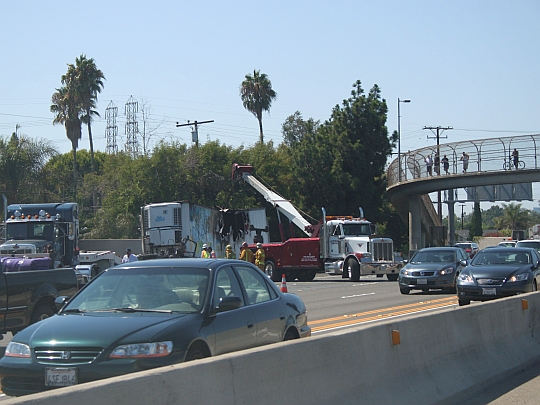
stuck-truckIn the interest of getting home to start preparing dinner, we got on the interstate again and headed back. A couple of miles before we got to the place where the fire occurred, traffic again slowed down. Not because of any obstruction, but because everyone had to rubberneck to see the clean up operations still underway three or more hours after the time of the accident. The three right lanes on the interstate were still closed where a flatbed and a crane truck were getting the burned-up big rig ready to get it off the road.

I snapped this photo as we passed in the opposite direction. Click to enlarge the picture and notice the people gathered in the elevated walkway on the right to watch the clean up operation.

Traffic sped up to normal after we passed, but we saw that the opposite traffic was backed up along the interstate for over 17 miles.

Other than the inconvenience, it was a pretty good day.

Vacation Flashback

Almost three weeks after it was over, I still go and look at the vacation pictures. I stitched together a group of photos to produce this nice panoramic view of Grand Canyon from the Watchtower near the east end of the National Park. Click on the thumbnail to open the large image viewer.

desert view

Fairyland

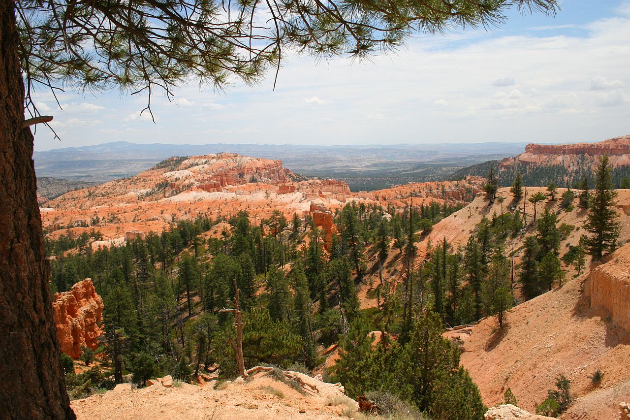
“Fairyland” is the nickname for this view from the top of Bryce Canyon. I cannot disagree with that . . .

fairyland

Click to see the ginormogantic size.