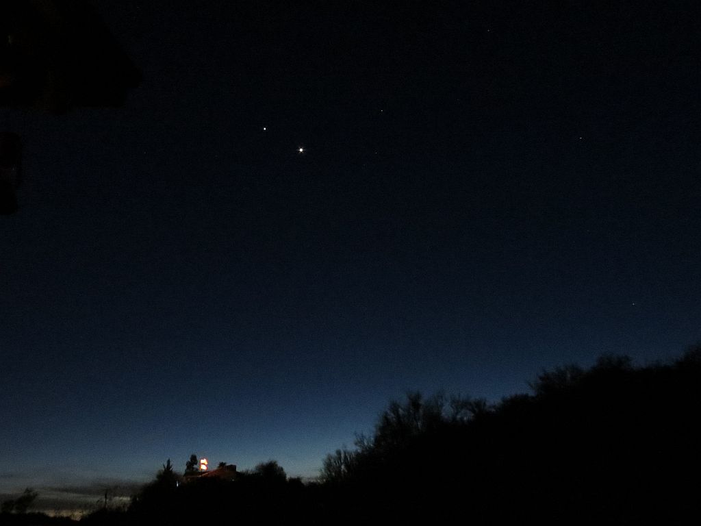
Planets Jupiter and Venus are currently gathered in the western sky as they do from time to time. This evening, I went out with the new camera on a tripod and played around with some of the settings and modes to get this image of the conjunction in the twilight. I took this image using the AV or “aperture priority” mode on the camera. You can see the two brightest objects are Jupiter (left) and Venus. Our neighbor’s illuminated flagpole is visible near the bottom of the frame. Click on the image to enlarge.
Astronomy
2012 Annular Eclipse Trip Update
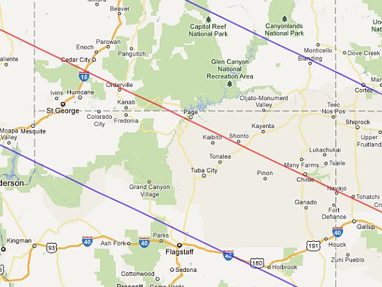
Since February, we have modified our plans to view the Great Annular Solar Eclipse of 2012. We originally thought that we would like to view the eclipse from Chinle, AZ, near Canyon de Chelly National Park. That would have been nice, but although the RV campgrounds in that area are nice, they don’t offer full hookups for the new travel trailer (electric, water, sewer). So, we redirected our target to another Arizona location near the center line of the eclipse path: Page, AZ, near Lake Powell and the Glen Canyon Dam.
I called the campground and confirmed our reservations for the nights of May 19 and 20. The eclipse will occur near sundown on the 20th. If the weather cooperates, we should have front-row seats for the show. I also ordered custom eclipse shades specifically printed for for the 2012 event from Rainbow Symphony.
We also planned a few other stops to maximize our journey into Northern Arizona. Don’t forget that there are some other attractions nearby, such as Grand Canyon, Wupatki, Sunset Crater and lots of Apache and Navajo sights. It’s going to be fun.
Solar Coronal Mass Ejection (CME)
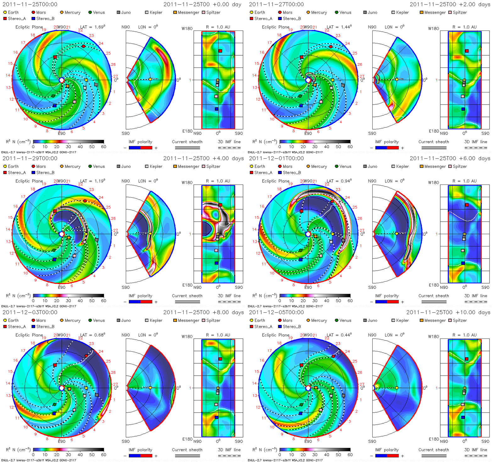
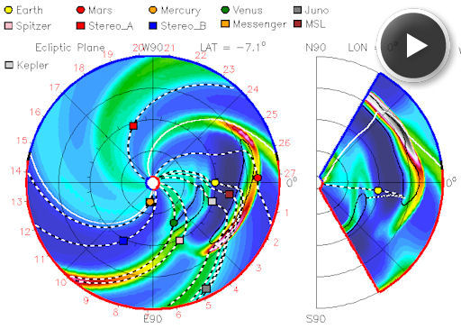 I just love these 3D colorized graphics that depict the motion of solar events in space. This one shows a CME directed almost directly toward Earth and Mars. Click on the image at right to view the animated CME path as forecast.
From SpaceWeather.com:
CME TARGETS EARTH, MARS:
A coronal mass ejection (CME) launched from the sun on Feb. 24th appears set to hit both Earth and Mars. According to analysts at the Goddard Space Weather Lab, the cloud should reach Earth today, Feb. 26th around 1330 UT, followed by Mars two days later. Click to view the CME’s animated forecast track.
Planning for the 2012 Annular Solar Eclipse
 As Jack Horkheimer used to say (before passing) “keep Looking Up.” That’s why we’re starting to plan for a fairly short trip in May to witness an annular solar eclipse. The path of maximum eclipse extends from Asia, across the Pacific and then through the western United States. The path in Arizona will pass over Page and continue into New Mexico to Albuquerque.
Image: Path of maximum annular eclipse. Click to enlarge
Our target destination will be to go to Chinle, AZ, adjacent to the Canyon De Chelly National Park. In the image, you can see that the red path goes right over Navajo land and just along the southern part of the national park. Our plan is to tow a travel trailer to the area and find a place to camp after the eclipse that will occur on May 20, 2012.
I’m ordering some eclipse shades and a solar filter for each of our two cameras for the event. We are hoping for some excellent pictures of one of the most spectacular events to happen on Earth.
Solar Radiation Storm and CME
These colorful solar animations are always very interesting to me. Click animation below to view full-sized version.
From SpaceWeather.com:
A radiation storm that began on Nov. 26th when a magnetic filament erupted on the sun is subsiding. Nevertheless, the Earth-effects are just beginning. The same explosion that caused the radiation storm also hurled a CME into space at about 930 km/s (2 million mph). According to analysts at the Goddard Space Weather Lab, the CME will reach our planet on Nov. 28th at 17:21 UT (+/- 7 hours).
Solar Plasma Flow
This video compresses about an hour of solar activity around a sunspot to a little over ten seconds.
Via APOD:
The Sun’s surface keeps changing. The above movie shows how the Sun’s surface oozes during a single hour. The Sun’s photosphere has thousands of bumps called granules and usually a few dark depressions called sunspots.
Four Moons of Saturn
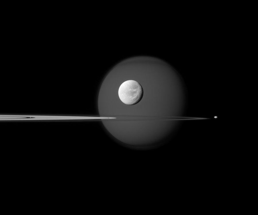
Today’s Astronomy Picture of the Day is a spectacular view of four of the moons of Saturn and a partial view of the rings. Image and the explanation below courtesy of APOD and NASA. You may need to click on the image to enlarge it to original size to see the fourth moon “Pan.”
Explanation: A fourth moon is visible on the above image if you look hard enough. First — and farthest in the background — is Titan, the largest moon of Saturn and one of the larger moons in the Solar System. The dark feature across the top of this perpetually cloudy world is the north polar hood. The next most obvious moon is bright Dione, visible in the foreground, complete with craters and long ice cliffs. Jutting in from the left are several of Saturn’s expansive rings, including Saturn’s A ring featuring the dark Encke Gap. On the far right, just outside the rings, is Pandora, a moon only 80-kilometers across that helps shepherd Saturn’s F ring. The fourth moon? If you look closely in the Encke Gap you’ll find a speck that is actually Pan. Although one of Saturn’s smallest moons at 35-kilometers across, Pan is massive enough to help keep the Encke gap relatively free of ring particles.

