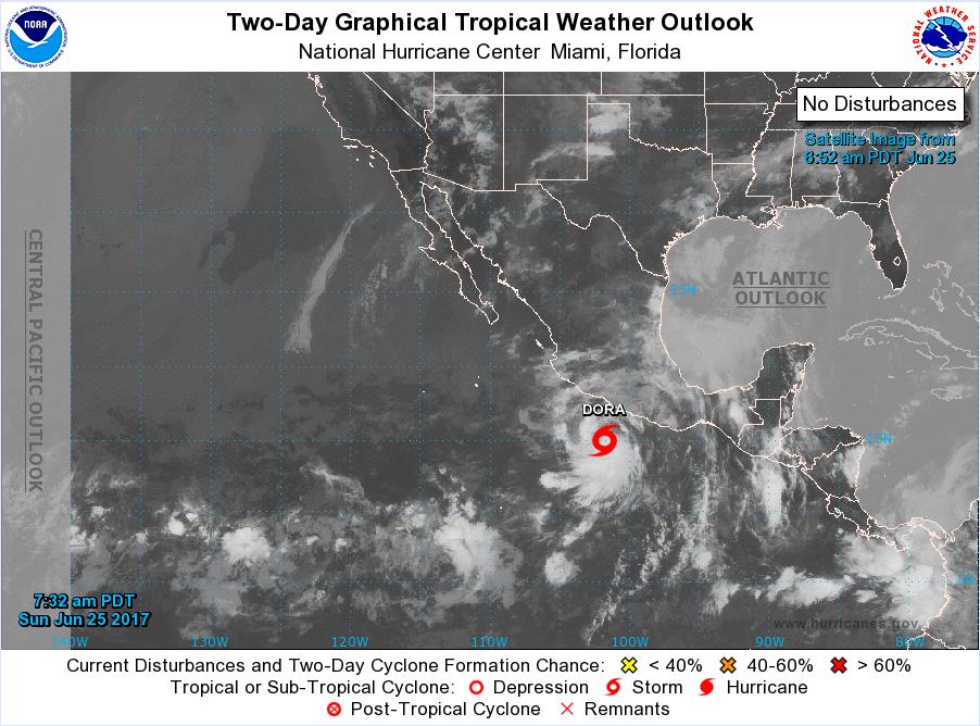
A large part of the elements that contribute to our summer monsoons here in Sonoran Arizona is the influence of Eastern Pacific Ocean tropical activity. When storms form west of Mexico and move northwestward (as they usually do), they introduce a flow of tropical moist air across the southwest. The counter-clockwise circulation around the storms forces moist air northward in the lee of the storm’s movement.
Currently, Tropical Storm Dora, which is forecast to become a hurricane by tomorrow, is moving west-north westward into the Pacific Ocean. Dora, seen just to the north of the inter-tropical convergence zone (the horizontal string of clouds near the bottom of the image above), is already pumping large amounts of moisture across Honduras, the Yucatan and much of Southern Mexico. As the storm moves away from the land mass, it will probably start pumping some of that moisture northward.
In July of 2015, Tropical Storm Danielle was responsible for a northward flow of tropical moisture that resulted in a severe monsoon over our area that dropped over five inches of rain in less than two hours. The Casandro Dam catch basin filled to capacity, the washes and Hassayampa river were all in flood stage. Hopefully, Dora will drift westward and not be a problem for us.


Those storms can pump moisture all the way up into the upper Midwest. I remember getting drenched in the Chicago area by hurricanes down in the gulf.
After we get settled in Colorado I get to learn a whole new set of weather patterns, including seasonal variations!
Yep Colorado is a great place to experience the four seasons. We get them here too, but with way fewer snowflakes in the winter. It has snowed and stuck precisely one time in the six winters we have been here.
With the Pacific hurricanes starting, maybe that will open the door for our monsoon thunderstorms.
We monitored the radar and lightning strikes and observed some monsoon activity up by the Mogollon Rim and in southeastern parts of our state. There were also monsoons in New Mexico over the past couple of days thanks to Dora.
We haven.t seen anything like that so far in our neck of the desert, but inevitably we will.