Environment

Bright Angel Canyon – Summer and Winter

Bright Angel Creek, part of the greater Grand Canyon complex, empties into the Colorado River just below Grand Canyon Village. The creek formed Bright Angel Canyon in much the same way the Colorado eroded its way through Grand Canyon. When you look down from the Village, you look straight into Bright Angel Canyon.

summer-bright-angel.jpgDuring the summer months, the sun is high in the sky at mid-day and the vivid colors of the sculptures in the canyon are truly inspirational. The sky can be gray with frequent thunderstorms in the area, or it can be blue, with flat-bottomed cumulus clouds floating above the canyon rim. The summers are warm at the South Rim with temperatures ranging between the high 70s and low 90s. When I took this shot of the canyon last summer, the temperature was in the low 80s.

winter-bright-angel.jpg
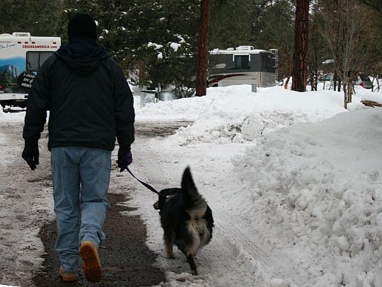
Winter brings a variety of conditions, ranging from fog and low clouds that obscure the canyon, to high winds which chill to the bone. Occasionally, a cold front will bring snowfall that can last for several days and will ice things up pretty good. The latter condition prevailed during our recent visit to the canyon. We stayed in the trailer village overnight and went to the rim to capture this winter view with low sun angle and long shadows. The snow was pretty deep in most places and the roads were pretty icy.

You can click on either image to enlarge.

Lows and Highs

20-mule.jpgWhen we got up this morning, we were in Pahrump, Nevada, near the eastern gateway to Death Valley National Park. We drove from there to Furnace Creek, near the lowest point in the continental United States. The elevation here was about 190 feet below sea level. The actual low spot is about minus 282 feet at Badwater Basin. We stopped at the village and took this picture of the wagons that were hitched to the famous 20 Mule Teams that hauled borax from here to Mojave, a considerable distance to the southwest. We then went from Furnace Creek to Scotty’s Castle, another interesting historical landmark in the park.

mt-whitney.jpgAfter we finished touring Death Valley today, we headed westward along California State Route 190, which took us over two mountain passes with winding and narrow roads. We went over the first pass and descended to Panamint Valley. Then over the White Mountains to descend into the Owens Valley, just east of the Sierra Nevada Mountains, where the highest point in the continental United States, Mount Whitney, looms at 14,491 feet above sea level. Mount Whitney in the picture to the left is not the one that looks tallest, since the linear perspective makes the peak to the left look taller. Mount Whitney is the peak among the very jagged peaks near the center and just to the right – it’s the one that looks tallest among those jagged peaks.

Click on either image to enlarge. Photo credits – Damsel.

Winter Canyon from Lookout Studio

As promised, here is one of the photos I took this morning at the Grand Canyon Village. This is looking northeast near Bright Angel Trail Head. The icicles are hanging from the famous Lookout Studio near Bright Angel Lodge.

winter-canyon.jpg

Click the image for large view.

First Snow

First of all, we hope everyone is having a very Merry Christmas.

Our journey on this Christmas Day started in Wickenberg, Arizona. We traveled across the north side of Phoenix, got on Interstate 17 and got as far as Flagstaff. We’re currently parked in an RV campground.

This was the first time our dog, Bear, ever saw snow. She was great with it! She romped in it a little and then decided that the RV cab was where she wanted to be.

This is the Cap’n and Bear as they walk back to the RV after having enough snow for a while.

first-snow.jpg

Mount St. Helens Pseudo Movie

In October of 2004, the Mount St. Helens Volcano went through a period of relatively high activity. The frames that went into this pseudo-movie all happened on the morning of October 4, 2004 within an hour and 15 minutes or so. Please note that I added the sound for dramatic effect and the time scale is highly compressed.

Keeping an Eye on Mount St. Helens

mt-st-helens.jpgEvery once in a while I will tune my browser to the Volcano WebCam, located at the Johnston Ridge Observatory, northeast of the famous volcano, Mount St. Helens. They used to have a very basic low-resolution image a few years ago, but since then have upgraded to a variety of resolutions, including both high and low.

I downloaded this image today late in the afternoon (Pacific Time). Click the thumbnail for a larger view.

They say this about their current capability:

These are near real-time images of Mount St. Helens, taken from the Johnston Ridge Observatory (JRO) using our VolcanoCam Classic camera and the new VolcanoCamHD camera. The (JRO) and VolcanoCams are located at an elevation of approximately 4,500 feet, about five miles from the volcano. You are looking approximately south-southeast across the North Fork Toutle River Valley. The VolcanoCam images automatically update approximately every five minutes.

I have a pseudo movie of an eruption event somewhere – I’ll post it when (and if) I find it. Meanwhile check out the cameras at Mount St. Helens during daylight hours (Pacific time).

Firestorm Caused by a Bird?

orange-sun.jpgA Local brush fire is now under control, but not before the smoke nearly blotted out the sun. Fine, white ashes continue to fall here, even after sunset. This is how the sun looked mid-afternoon from the back yard. Click to enlarge.

SoCal Edison blamed the fire on a bird. From the Daily Breeze:

Firefighters mopped up the remnants of a 10-acre brush fire this afternoon that briefly threatened the Rancho Palos Verdes City Hall earlier in the day.

Unlike fires raging elsewhere in Southern California, the one on the Palos Verdes Peninsula was put out quickly. It took about 100 firefighters and two helicopters about an hour to extinguish it, authorities said.

The fire was reported at 11:02 a.m. It burned in a canyon near Hawthorne Boulevard and Palos Verdes Drive South.

“It started to go to the city yard,” said Los Angeles County Fire Capt. Jeff Vroomes. “That was our priority. We made an aggressive attempt to get in front of it.”

No homes were immediately threatened.

Southern California Edison officials determined the fire was caused by a bird that landed on power lines. After being killed by electricity and catching fire, the animal fell into the dry brush, Vroomes said.