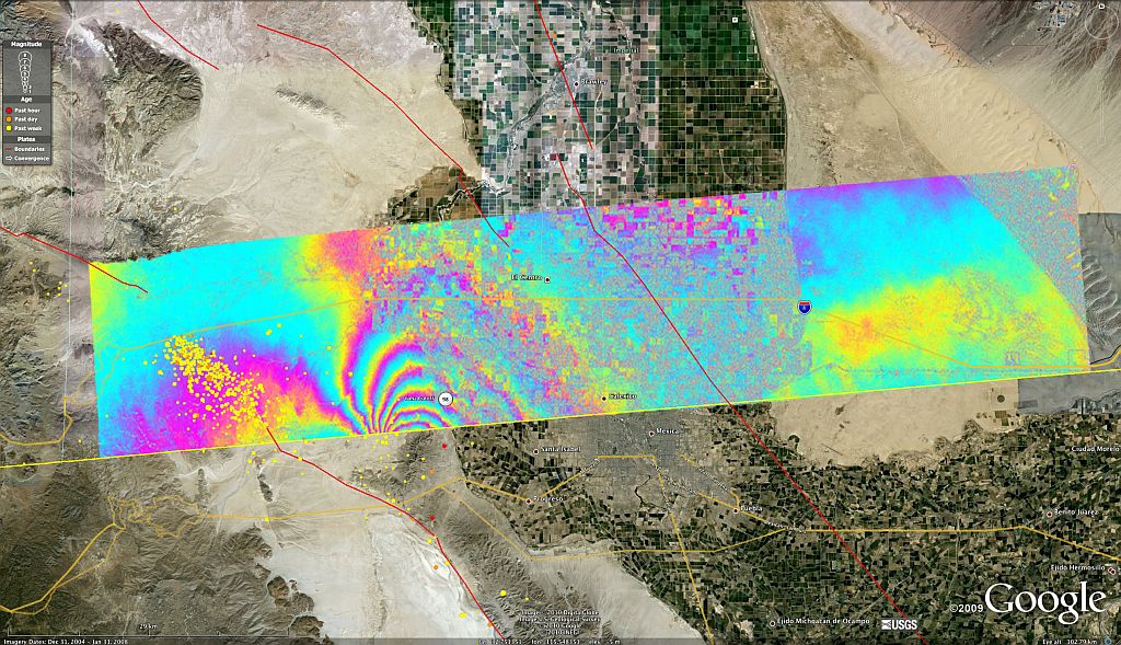
The 7.2 Baja earthquake of April 4, 2010 and numerous aftershocks have displaced the land around Calexico, CA, about 31 inches. From NASA:
NASA Radar Images Show How Mexico Quake Deformed Earth
PASADENA, Calif. — NASA has released the first-ever airborne radar images of the deformation in Earth’s surface caused by a major earthquake — the magnitude 7.2 temblor that rocked Mexico’s state of Baja California and parts of the American Southwest on April 4.
The data reveal that in the area studied, the quake moved the Calexico, Calif., region in a downward and southerly direction up to 80 centimeters (31 inches). The maps can be seen at: http://www.nasa.gov/topics/earth/features/UAVSARimage20100623.html .
A science team at NASA’s Jet Propulsion Laboratory, Pasadena, Calif., used the JPL-developed Uninhabited Aerial Vehicle Synthetic Aperture Radar (UAVSAR) to measure surface deformation from the quake. The radar flies at an altitude of 12.5 kilometers (41,000 feet) on a Gulfstream-III aircraft from NASA’s Dryden Flight Research Center, Edwards, Calif.
The team used a technique that detects minute changes in the distance between the aircraft and the ground over repeated, GPS-guided flights. The team combined data from flights on Oct. 21, 2009, and April 13, 2010. The resulting maps are called interferograms.
Overview of the UAVSAR interferogram of the magnitude 7.2 Baja California earthquake of April 4, 2010, overlaid atop a Google Earth image of the region. Major fault systems are shown by red lines, while recent aftershocks are denoted by yellow, orange and red dots. Image credit: NASA/JPL/USGS/Google
Click on the image to enlarge.
(More)

