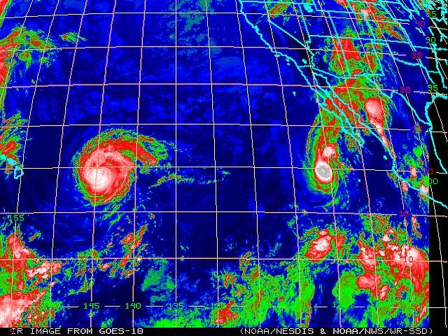
Ever since East Pacific Hurricane Delores fueled one of the most massive rain dumps on our little town last July 18th, I have been keeping an eye on the EASTPAC tropical weather activity. There are two named storms in the infrared satellite image above: Hurricane Jimena on the left and Tropical Storm Kevin off the Baja California coast. Jimena is sort of headed to Hawaii and Kevin is slowly moving west northwest. The activity at the bottom of the frame is the usual inter-tropical convergence zone where there is almost always some activity.
You can see Kevin is sending a lot of moisture up to the southwestern US via Baja California and the Sea of Cortez. The moist tropical air meets the heated surfaces of the deserts and convective activity is inevitable, hence afternoon or nocturnal thunderstorms.
We had a group of storms pass closely to the east of town before dissipating earlier this afternoon and evening. We had a few raindrops and quite a bit of wind, but the most severe activity was well south of us along I-10, west of Buckeye, AZ.
We are alert for more monsoon weather through the remainder of this week and into the Labor Day weekend. We are hoping for a mild weather weekend, ourselves.


Lucky you! We got Delores, then one thunderstorm a week later, in July. After that, nothing but eternal sunshine. (sunstorm?)
We’re getting the same treatment as we got yesterday. A sunstorm most of the day, followed by gathering clouds and a few raindrops this evening. Looking at the radar, we could wind up with some more. Not seeing any echoes out your way, though, Crotalus.