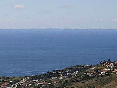
Today, we took a drive to the top of the Peninsula, since I had a hunch it would be very clear after the rain passed through the area overnight – Bingo! Right again! I took this shot of Santa Barbara Island, about 40 miles in the distance. Seldom seen due to coastal haze and fog, it was a rare treat to see St. Babs Island from the mainland. There were also breathtakingly clear views of Catalina and points up and down the coastline.

Santa Barbara Island is part of the Channel Islands National Park – From NPS:
Santa Barbara Island (639 acres), 38 miles west of San Pedro, is the smallest of the California Channel Islands. Formed by underwater volcanic activity, Santa Barbara is roughly triangular in outline and emerges from the ocean as a giant twin-peaked mesa with steep cliffs. Even though small in size, Santa Barbara Island boasts diversity in its habitats, with a few narrow rocky beaches, six canyons, and badlands area. It is much like Anacapa Island in its being a haven for sea birds. The steep cliffs and isolation from mainland predators provide safe breeding sites for thousands of sea birds
