This nice little collage of panoramas came from our trip to Arizona this summer. Please enjoy these nice views from the majestic Grand Canyon. If the show is over, click on “Replay.”
Travel
Tuzigoot
Tuzigoot is the Apache word meaning “crooked river.” This was the name arbitrarily given the Sinagua Native American ruins above a big bend in the Verde River near Cottonwood, AZ. This was an interesting stop that we made during our brief but fun vacation. Cap’n Bob also took a 3D picture of this ruin (you will need a pair of red/blue 3D glasses).
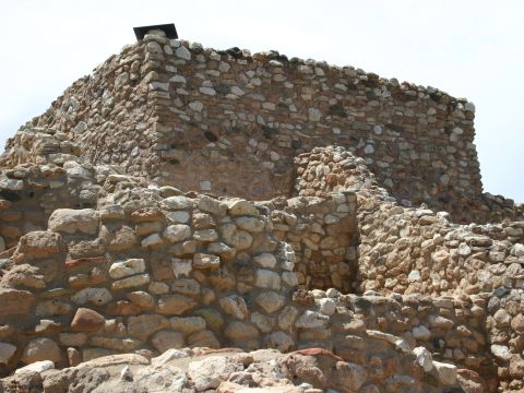
From the National Parks page on Tuzigoot National Monument
Crowning a desert hilltop is an ancient pueblo. From a roof top a child scans the desert landscape for the arrival of traders, who are due any day now. What riches will they bring? What stories will they tell? Will all of them return? From the top of the Tuzigoot Pueblo it is easy to imagine such an important moment. Tuzigoot is an ancient village or pueblo built by a culture known as the Sinagua. The pueblo consisted of 110 rooms including second and third story structures. The first buildings were built around A.D. 1000. The Sinagua were agriculturalists with trade connections that spanned hundreds of miles. The people left the area around 1400. The site is currently comprised of 42 acres.
Historic Route 66
Today, we drove part of Historic Route 66 from Kingman, Arizona through Oatman, Arizona. Wild but tame burros wander the streets of Oatman accepting handouts from tourists. I snapped a picture of this nice white burro walking up the street.
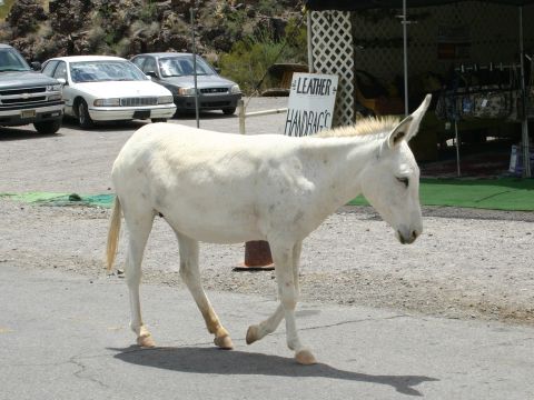
Oatman began about 90 years ago as a mining tent camp and quickly became a flourishing gold-mining center. In 1915, two miners struck a $10 million gold find, and within a year, the town’s population grew to more than 3,500.
Oatman was named in honor of Olive Oatman, who was kidnapped as a young girl by Mojave Indians and later rescued in 1857 near the current site of the town. Oatman was served by a narrow gauge rail line between 1903 and 1905 that ran 17 miles to the Colorado river near Needles, California.
But both the population and mining booms were short-lived. In 1921, a fire burned down many of the smaller shacks in town, and three years later, the main mining company, United Eastern Mines, shut down operations for good. Oatman survived by catering to travelers on old U.S. Route 66. But in the 1960s, when the route became what is now Interstate 40, Oatman almost died.
The Grand Canyon Watchtower
Today, we drove from Flagstaff to the Grand Canyon. We had wonderful weather and a great day at the rim. This is a picture of the Watchtower at Desert View scenic area. Notice the nest near the picture center — we saw many hawks in the canyon and this may be one of their nests. The American Flag on the right is in front of the ranger station there.
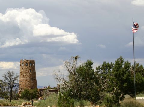
The Indian Watchtower is at the eastern end of the south rim of the Grand Canyon. From a distance the building’s silhouette looks like the Anasazi watchtower it was meant to mimic. In actual size the tower is considerably larger than any known Anasazi tower. In plan the structure is composed of one enormous circle at the north, a small circle at the south, an gently arced forms connecting the two. The largest circle and the arced portions are the sections of that building that are just one story in height. The smaller circular plan is for the tower itself, more than five stories high. The building sits out on a promontory overlooking the Grand Canyon.
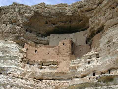
Montezuma’s Castle
Today, we started out in Payson, Arizona and drove to more Native American ruins — Montezuma’s Castle and Tuzigoot National Monuments.
This is a shot of Montezuma’s Castle near Camp Verde, Arizona. Two things though — it’s not a castle and Montezuma was never there.
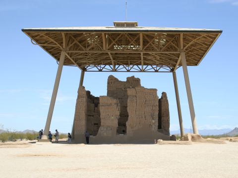
Big House in the Sun
“Casa Grande” is the Hohokam Native American ruins located near Coolidge, Arizona. The Hohokams had an interesting civilization. They farmed and irrigated crops using complex engineering skills. The four walls of this house are aligned with the four points of the compass. There is a feature where holes in the walls projected light onto a particular place on the wall to indicate equinoxes and solstices. Sort of like Stonehenge, I suppose. After our visit we headed to the Arizona High country. More on that tomorrow.
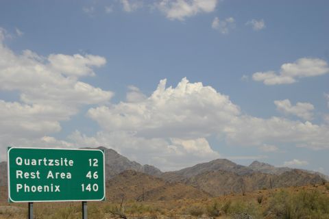
Gone to Arizona
We figured we needed a little change of scenery, so we decided to take a ride to some of our favorite places. Blue skies and green lights prevailed until we got to the monsoons and dust storms (after this picture was taken). Meanwhile enjoy the skies and mountains of Western Arizona as seen from I-10.