Google Earth
The actual location of the Four Corners Monument is off a bit, but not by the 2.5 miles reported by the Associated Press and a Salt Lake City newspaper.
However, legally (and symbolically), the Four Corners Monument is, indeed, on the spot where the borders intersect, since the Supreme Court of the United States decreed it to be so in 1925. Political boundaries are, after all, at the behest of politicians and judges.

Google Maps
However, the actual intersection of the defined longitude and latitude may be as far away from the monument as six hundred meters.
I found the Four Corners monument using both Google Earth and Google Maps. Even between the two Google sources, they disagree. They both show a segment of border that runs slightly west from the monument. I could find no reference to the anomalous segment.
I checked several other on-line map sources and no two agree. Some show the anomalous border segment and some do not.
The Arizona Geology Blog has a brief post about the confusion.
Wikipedia has already picked up on the cause of the erroneous report:
The Four Corners Area is generally defined as a circle around the Four Corners Monument located at 36° 59″ 56.31532′ N by 109° 02″ 42.62019′ W. A series of news stories from April of 2009 indicated that more recent surveys had determined that the intersection of the corners was not where it was intended to be.
However, the news stories used whole degree co-ordinates, not accounting for the fractional degree offset between the Washington Meridian, standard used at the time, and the current standard, the Prime Meridian. In addition, general U.S. land principles, law, and the Supreme Court have determined that the location of the monument is the legal corner of the four States.
Click on either image to enlarge.
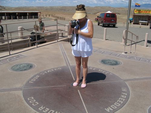
This picture shows Damsel standing on the Four Corners Monument the last time we were there.